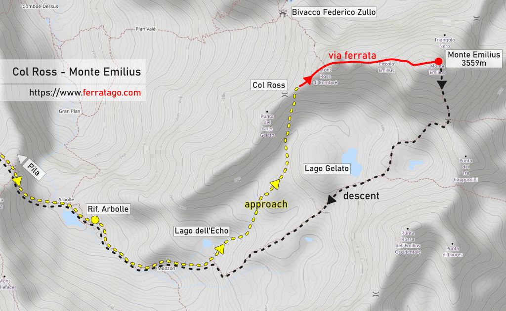
This tour of Monte Emilius is a long, demanding mountaineering route, which includes a variant of the original via ferrata in the last part to the 3559 m summit.
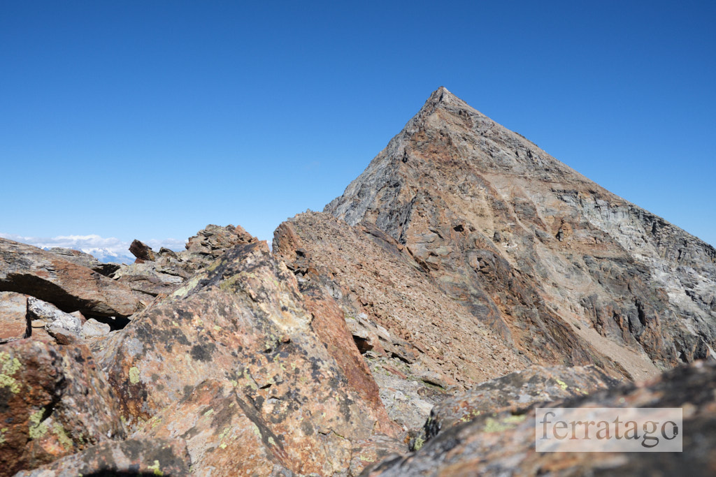
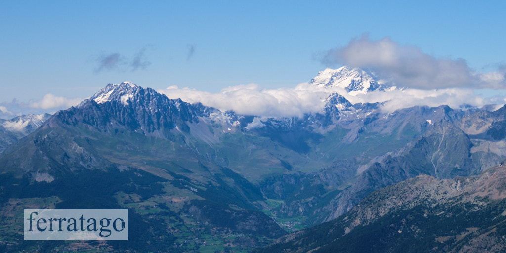
Named after 14-year-old girl Émilie Argentier, the pyramid-shaped Monte Emilius towers above the Aosta town and from its top, but also along the way, offers excellent views towards 4000 m peaks such as Mont Blanc, Monte Rosa, Matterhorn and Grand Combin.
The route is usually split in two days, with a night at Rifugio Arbolle (hut), but if you wish to challenge yourself, the 22 km long tour can also be done in 1 day, if you start early enough. Don’t underestimate the overall required effort!
Summary
Grade: C
Vertical: 650m ferrata, 2000m total
Time: 4h approach, 4h ferrata, 5h descent, 13h total
Access / Parking: 45.6877,7.3109 – Google Maps or any Android maps app
Start via ferrata: 45.6824,7.3685 – Mapy.cz or any Android maps app
Download gpx track
Map and photos
Access
You get to ski resort Pila by driving up the winding road from Aosta valley or, if you don’t plan for an early start, you can also take the cable car from Aosta to Pila. In this case, plan your return times well because you’ll be relying on the cable car to get back down to Aosta.
Approach to start
From Pila we can either hike or take the chairlift to Chamolè mountain station, then continue on foot to Lago Chamolé, Col de Chamolé (2649 m), Rifugio Arbolle (Arbolle hut). Here we can spend the night and start early the next day or continue the ascent and spend the night on the way down. Fit and well prepared mountaineers can cover the entire tour in 1 day, but take into consideration the official time of around 9 hours from Arbolle to the summit and back to Arbolle.
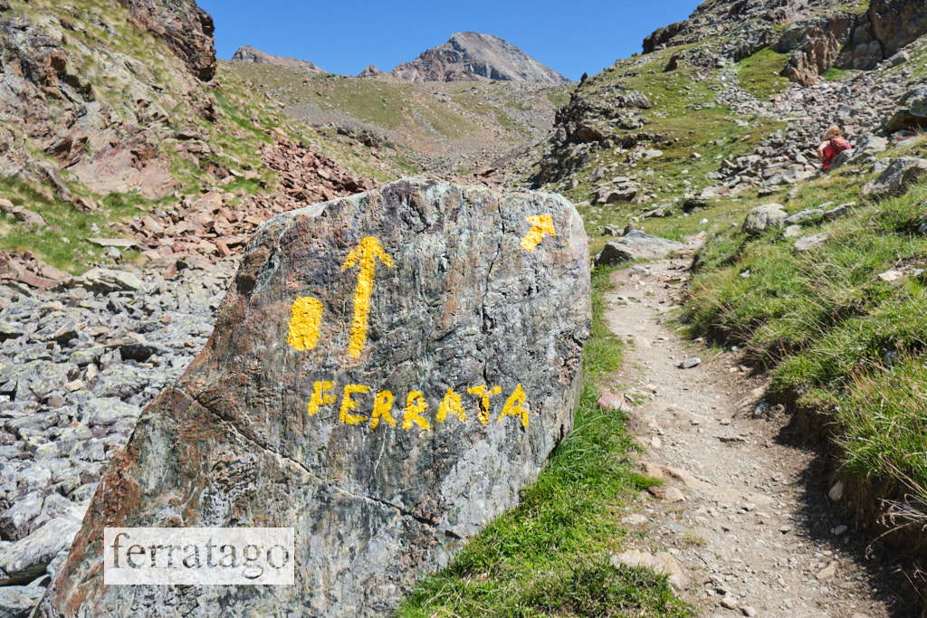
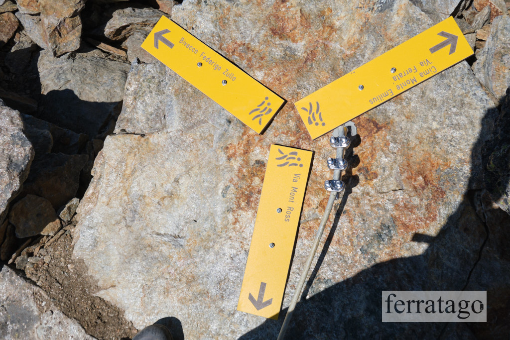
From Arbolle hut continue on the normal trail, path 14, to the summit until you find a large boulder right next to the path, with yellow arrows and the word “ferrata” on it. Here the regular paths 14 and 102 continue on the right and the yellow lines markings pointing to the via ferrata go forward. With Lago dell’Echo close by on our left and a water stream echoing under the rocks, this is also the last place to refill your water bottles.
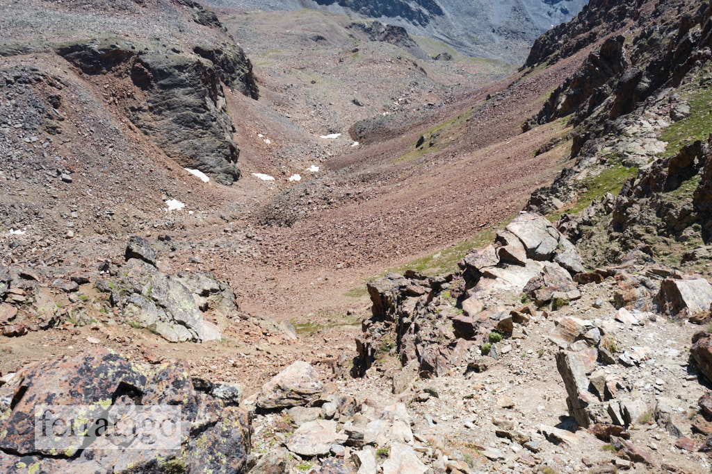
The rest of the approach is harder than a regular hiking trail, but well marked as of August 2023, with yellow lines showing the direction. We follow these markings, stepping on rocks until we reach Col Ross (3091 m). The last part to this mountain pass is steep and from here we can see the start of the cable a bit further up the ridge. Down on our left, we can see Bivacco Federico Zullo at the start of the regular ferrata route, with its steep zig-zag approach path.
The route
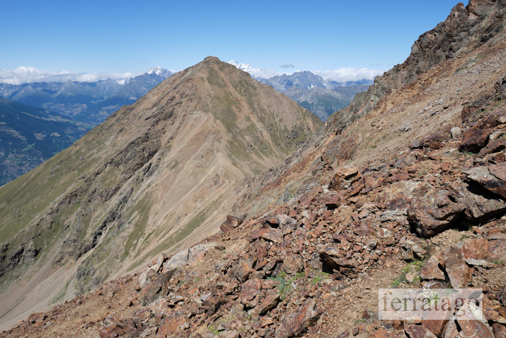
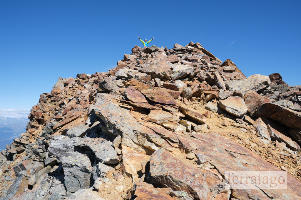
The cable winds up through the South-West rock ridge with beautiful climbing sequences on mostly natural holds. At Mont Ross di Comboé (3285 m) we join the regular ferrata and continue on the ridge towards Piccolo Emilius (3387 m) and Monte Emilius (3559 m), the summit of this tour.
Considered a bit more difficult than the older via ferrata, we found this variation to be of similar difficulty though, around grade C, but due to the long approach on rocky terrain combined with a long descent, the entire tour is very difficult and should not be underestimated.
Descent
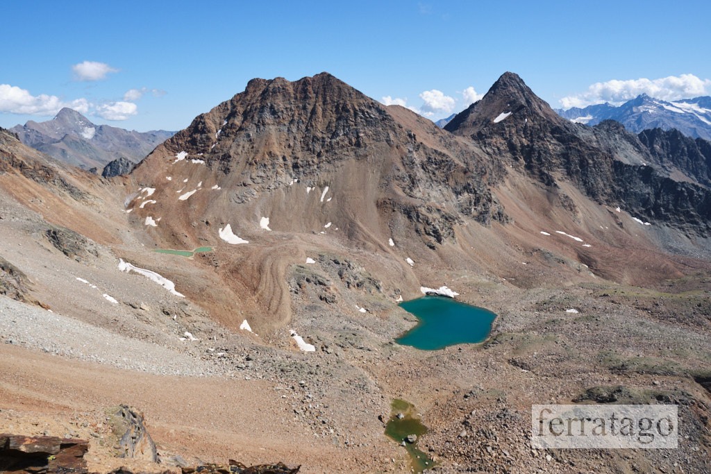
From the summit, descend via the normal route, path 14. The first part to Passo dei Tre Cappuccini (3242 m) and Lago Gelato has steep sections and big boulders and you’ll need to take your time here and descend safely.
From Lago Gelato continue to Rifugio Arbolle, Chamolé, Pila.
Good to know
- This variant of the original ferrata was built in 2021.
- The ferrata is only a segment from a serious mountaineering route with a total of about 2000m vertical distance and 22km long, with the summit at 3559 meters.
- Rifugio Arbolle (Arbolle hut) can be used to split the trip in two days.
- Excellent rock climbing passages for the entire route, with few artificial steps.
- The cable is covered in a thin plastic sheet, which might be tricky to handle when wet.
- At this altitude you will need stable weather as it can even snow in the Summer.
- Best time is from mid July to late September.
Donation box
I’m trying to keep this site ad free, supported by donations only via Buy Me a Coffee, PayPal or Bitcoin. Your support is highly appreciated.
Weather
Main sources
- lovevda.it
- we climbed the route on August 5, 2023