Via ferrata Hvadnik runs inside a canyon, an ideal tour for hot Summer days.
Summary
Grade: C – view topo
Vertical: 120m ferrata, 170m total
Time: 15min approach, 45min ferrata, 30min descent, 1h30min total
Access / Parking: 46.4846,13.8427 – Google Maps or any Android maps app
Start via ferrata: 46.4875,13.8454 – Mapy.cz or any Android maps app
Download gpx track
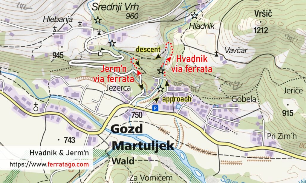
Map

Access
We arrive in Gozd Martuljek from either Kranjska Gora in the West or Mojstrana / Jesenice in the East. Gozd Martuljek is also connected with the nearby towns by a nice bike path, separated from the road.
Approach to start
The short approach starts at the paid parking lot near a sports ground and is well marked with signs. If you are camping at nearby Kamp Špik, you can start the approach on foot from there, with similar times.
The route
Hvadnik via ferrata follows the stream upwards, crossing it at times on suspension bridges. It is suitable for children too and it is equipped with open eyebolts, curly pigtail bolts for easy running an additional rope through them as extra protection for your younger teammates.
Descent
Follow the marked trail back to the start. Close to where the cable ends, we pass near a meadow with a hut called Brunarica Krmiše, a good place to take a break.
Good to know
- Not recommended if the water level is high in Hvadnik Gorge, after heavy rainfalls.
- On your descent, you pass close to the start of Jerm`n (D/E) via ferrata and you can combine the two.
Donation box
I’m trying to keep this site ad free, supported by donations only via Buy Me a Coffee, PayPal or Bitcoin. Your support is highly appreciated.
Video
Weather
Main sources
- bergsteigen.com (German)
- tadejatravels.com (Slovenian)
- we climbed the route on August 5, 2022
